Census-designated place / unincorporated community
About Agua Dulce
Agua Dulce is a Census-designated place / unincorporated community in Los Angeles County, connected to the Southwest foothills area of the Antelope Valley guide. The label matters. Some places in this section are incorporated cities with their own municipal governments, while others are census-designated places, unincorporated communities, rural town areas, county islands, military base communities, neighborhoods, or regional gateways. Calling everything a city would be easier, but it would flatten the way locals actually understand the valley.
This page is built as a practical local guide and a stronger community profile at the same time. It gives residents a page that names their place correctly, gives visitors a useful starting point, and keeps the facts clear: what the place is, where it sits, what official sources support the label, what nearby communities connect to it, and what a person can actually do in the area.
For locals, Agua Dulce is not just a dot on a regional map. It is part of a daily geography of schools, county services, city errands, desert roads, foothill routes, parks, libraries, museums, base access, business corridors, and weekend trips. For visitors, it is a way into the Antelope Valley beyond a single freeway exit or a quick pass through Lancaster and Palmdale.
Community Character
The southwest foothills feel like the Antelope Valley easing into canyon country. Roads curve more, homes sit closer to ridges and washes, and the landscape shifts from open valley floor to chaparral, rock formations, equestrian properties, trail access, and rural community centers.
The best way to understand Agua Dulce is to look at both the official sources and the lived pattern around it. The official side tells you whether the place is a city, CDP, unincorporated community, or regional destination. The lived side comes from the nearby communities, civic anchors, parks, libraries, museums, roads, and landmarks people use when they describe where they are from.
Agua Dulce belongs in this guide because the Antelope Valley is a region of named places, not just a pair of anchor cities. Some communities have city halls and large park systems. Others have county planning documents, branch libraries, local chambers, rural preservation areas, community standards districts, museums, parks, or neighboring guides that make the local identity visible. This page brings those pieces into one place.
Population And Place Type
Place type: Census-designated place / unincorporated community. County or region: Los Angeles County. Guide cluster: Southwest foothills.
For population context, Census Reporter lists Agua Dulce, CA at an estimated 2,828 residents in the ACS 2024 5-year dataset. Census estimates are best read as planning context rather than a head count of every address, especially in rural and fast-changing high-desert communities.
Population and place labels can be confusing in the high desert because the words people use every day do not always match government categories. A community can be deeply real to residents without being incorporated. A census-designated place can have a federal statistical boundary without a city council. A neighborhood or county island can sit next to city services while remaining under county jurisdiction. This guide uses the most accurate label available so readers do not mistake local identity for municipal status.
- Agua Dulce is listed by the U.S. Census as a census-designated place.
- The existing page URL misspells the community as “Aqua Dulce”; keep the URL in place to preserve links, while using the correct community name in page copy.
- Use official park and county links for geography, access, and amenities.
Local Spots, Parks, Libraries, And Civic Anchors
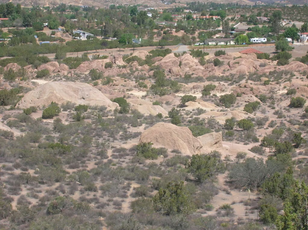
A useful Agua Dulce guide points readers toward real places and reliable resources, not vague travel copy. Good starting points for this page include Vasquez Rocks Natural Area – LA County locator, Acton & Agua Dulce community/chamber resource, Pacific Crest National Scenic Trail – U.S. Forest Service, and Acton Agua Dulce Library – LA County Library. These links are a mix of official government, park, library, museum, chamber, civic, or AntelopeValley.com guide resources, depending on what is available for the community.
- Vasquez Rocks Natural Area – LA County locator
- Acton & Agua Dulce community/chamber resource
- Pacific Crest National Scenic Trail – U.S. Forest Service
Library And Learning Resources
Agua Dulce readers can also use the public library link below for programs, study space, research tools, children's services, digital collections, or branch information where available.
County parks, city facilities, libraries, museums, visitor centers, chambers, and official planning pages do more than fill a source list. They show how a community functions. They tell a visitor where public access is appropriate, help a new resident find services, and give longtime locals a cleaner way to explain their part of the valley to friends, family, clients, or guests.
When a page has fewer public attractions, that is handled honestly. Rural communities may have fewer official visitor stops, but they still deserve accurate coverage. In those cases, this guide leans on county planning sources, nearby community pages, events, business listings, and public parks or libraries in the surrounding area instead of inventing attractions that do not have a reliable source.
Things To Do In And Near Agua Dulce
This is a good cluster for travelers who want a scenic drive, a park stop, a trailhead, or a quieter counterpoint to the busier city corridors. It also gives residents a strong local identity: close enough to Palmdale and Lancaster for services, but distinct enough to feel like its own foothill world.
For a simple outing, start with the strongest official anchor on the page, then connect it to nearby communities: Acton, Palmdale, Leona Valley, and Green Valley. That might mean a park stop, a museum visit, a library program, a community event, a scenic drive, a state park, a national forest route, a city arts venue, or a local business found through the AntelopeValley.com directory.
Visitors should pay attention to distance, weather, daylight, road conditions, and public access. The Antelope Valley can look close on a map while still requiring real drive time, especially between foothill communities, mountain gateways, and East Kern desert destinations. In summer, heat matters. In the mountains, storms and closures can matter. In rural areas, private property boundaries matter. The best trips are planned with official links open and a flexible sense of time.
Locals can use this page differently. Instead of treating Agua Dulce as a tourist checklist, use it as a hub: check events near the community, browse local businesses, look at nearby guides, and follow the official links for parks, libraries, planning, museums, or civic updates. The page should earn its keep by being useful to the people who live here.
A Good Day Around Agua Dulce
A good day around Agua Dulce starts with orientation. Look at the place label, scan the nearby communities, then choose one public anchor from the highlights list. If the page points to a park, library, museum, city site, visitor center, chamber, or forest resource, that is usually the best first stop for current hours, rules, programs, and visitor information.
From there, build outward. Pair Agua Dulce with Acton, Palmdale, Leona Valley, and Green Valley, then add a meal, a local shop, an event, a trailhead, a museum, or a scenic drive where sources support it. The goal is not to rush through every name in the valley. The best Antelope Valley days are usually slower: enough time to notice the sky, the roads, the ridgelines, the wind, and the difference between one community and the next.
If you are new to the area, this page can also help you ask better questions. Is Agua Dulce incorporated or unincorporated? Which county serves it? What is the nearest library or official park? Which nearby communities share services or identity? Which official source should you trust for current details? Those answers make relocation research, weekend planning, and local storytelling much easier.
Why Locals Are Proud
People are proud of the space, the local stewardship, the neighborly scale, and the way the landscape announces itself. The foothills make the Antelope Valley feel less like a single flat map and more like a collection of places with their own texture.
What makes Agua Dulce worth covering is not always the presence of a famous attraction. Sometimes it is the way a name holds a landscape together. Sometimes it is a library, a county park, a stretch of road, a civic district, a museum, a base, a mountain gateway, or a cluster of neighboring communities that locals know instinctively. Good community pages should make that knowledge visible.
This guide is written to make residents feel recognized and to make visitors more respectful. That means using sourced claims, naming local spots when sources are available, avoiding made-up film credits or invented folklore, and giving readers direct links to the agencies and organizations that can confirm details. Pride and accuracy belong together.
Nearby Communities To Explore
Agua Dulce connects naturally with Acton, Palmdale, Leona Valley, and Green Valley. Follow those pages to understand how the community fits into the larger Antelope Valley, from the city centers and westside rural areas to the foothills, East Kern desert, aerospace corridor, and mountain gateways.
The Antelope Valley rewards people who learn its local names. Once you know the difference between an incorporated city, a census-designated place, an unincorporated community, a neighborhood, a military base community, and a regional destination, the map becomes richer. Agua Dulce is one part of that larger story.
Fun Fact
Fun fact: Agua Dulce Airpark stood in for Le Mans in Ford v Ferrari, with production building grandstands, pits, and garage structures on the runway. Source: Los Angeles Times.
Movies Filmed Here
Ford v Ferrari (2019): The Los Angeles Times reported that the production recreated Le Mans structures at Agua Dulce Airpark. This guide lists the filming note only because that reporting specifically names Agua Dulce. Source: Los Angeles Times.
Events Near Agua Dulce
- Bingo at Agua Dulce Winery
- Embroidered Bookmarks
- Happy 250th Birthday USA
- The Moon & Cookies
- Life in a Pond
- Smarty Pants Storytime
Local Businesses
Nearby Communities
Related Guides
Official Links And Sources
- U.S. Census TIGERweb CDP file
- LA County adopted Community Standards Districts
- Vasquez Rocks Natural Area – LA County locator
- Acton Agua Dulce Library – LA County Library
- Agua Dulce, CA population profile – Census Reporter
- Wikipedia overview – secondary source for orientation and citation discovery.
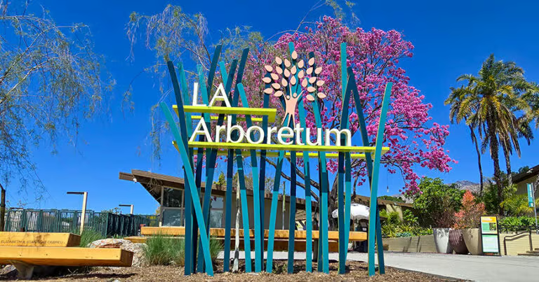
- Local area image: Vasquez Rocks. Image source.
