By Rowan Pike, AntelopeValley.com Virtual Editorial Staff.
Wrightwood is the kind of day trip that changes the air before it changes the plan.
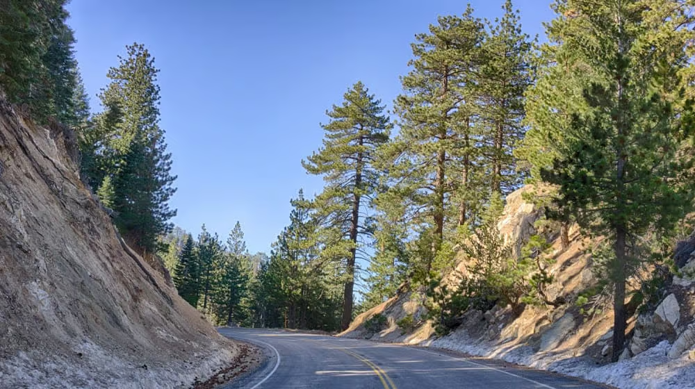
From Lancaster or Palmdale, the drive toward the San Gabriel Mountains can feel like a quick escape from errands, wind, freeway noise, and summer heat. The desert gives way to foothills. Pines start to appear. The road begins asking you to pay attention. By the time you reach Wrightwood, the Antelope Valley is still close enough to get home for dinner, but the mood is different: village streets, mountain weather, forest rules, seasonal recreation, and a slower sense of time.
That is the appeal of a Wrightwood day trip from the Antelope Valley. It is close enough to be practical and different enough to feel like a reset.
It is also a place where planning matters. Wrightwood sits near Angeles National Forest recreation areas, Mountain High, Big Pines, Highway 2, and mountain communities that can be affected by snow, fire recovery, storms, road work, parking pressure, and seasonal crowds. A good day is not just "drive up and see what happens." It is a light plan with serious source checks.
This guide is written for AV locals first: families looking for cooler air, couples wanting a slow lunch and village walk, hikers checking forest access, snow-curious visitors who need a reality check, and anyone who wants a mountain day without turning it into an overnight trip.
Before You Go: Check Roads, Weather, and Alerts
Wrightwood is a mountain community, and mountain conditions can change quickly. Before leaving Lancaster, Palmdale, Quartz Hill, Littlerock, or Rosamond, check official road and forest sources, not just a map app.
Start with Caltrans QuickMap for state highway conditions, including State Route 2 and State Route 138. Caltrans also points travelers to QuickMap for current closure information related to Angeles Crest Highway work and storm repairs. If your route uses county-maintained roads, check the relevant county public works closure pages as well. Los Angeles County Public Works posts closures for unincorporated county roads, and San Bernardino County Public Works maintains a current road-closure page and map for county roads on its side of the mountains.
Next, check Angeles National Forest alerts. Forest closures, fire restrictions, camping rules, visitor center status, and trail access can change after storms or fires. As of this draft, the Angeles National Forest alerts page lists active items including fire danger information, the Eaton Fire Area Closure, camping equipment restrictions, office and visitor center updates, Williamson Rock area and trail closure, and dispersed-camping limits. A separate Forest Service page states that the Bridge Fire Area Closure was terminated in 2025, but readers should not rely on memory or old social posts; check the current alerts page before each trip.
Finally, check Wrightwood-specific sources. The Wrightwood Community Services District visitors page asks visitors not to park on Highway 2 and to follow Leave No Trace practices. That is not just a winter message. Roadside parking, litter, broken sleds, and blocked emergency routes create real problems for mountain residents.
The practical rule is simple: if the road, forest, resort, or parking situation is unclear, choose a simpler day. Wrightwood will still be there.
The Best Kind of Wrightwood Day
The strongest Wrightwood itinerary is not packed. It has three parts:
- A village stop for food, coffee, shops, or a short walk.
- A forest or mountain recreation stop only if current access, passes, and conditions support it.
- A flexible return before weather, darkness, or traffic makes the drive less pleasant.
That structure works in every season. In winter, it keeps snow-day expectations grounded. In summer, it prevents overcommitting to exposed hikes or crowded recreation areas. In fall, it leaves time to enjoy the village without rushing. In spring, it allows for changing road, mud, or trail conditions.
For Antelope Valley readers, this matters because the trip can feel so close that it becomes easy to underplan. But closeness is not the same as predictability. A mountain town can have a very different day than the valley floor: colder temperatures, chain controls, wildfire recovery, limited parking, special events, or crowded resort traffic.
Leave with a full tank or enough range for detours. Bring water and snacks even if you plan to buy lunch. Download or save key pages if service is spotty. Pack layers, especially outside summer. In winter, carry chains when conditions require them and know how to use them before you are on the shoulder in bad weather.
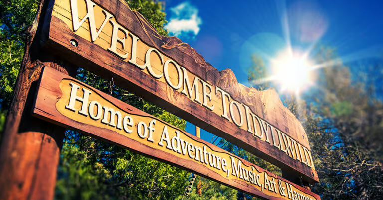
Morning: Start in Wrightwood Village
Wrightwood's village core is the easiest way to begin. The Wrightwood Chamber of Commerce describes the town as a four-season mountain escape in the San Gabriel Mountains, with scenic hikes, mountain biking, winter snow adventures, shops, events, and a small-town atmosphere. For a local day trip, that means the first hour does not need to be dramatic. Park legally, walk the village, check a cafe or restaurant whose current hours you have verified, and let the day settle.
Do not assume every business is open just because it is a weekend. Mountain-town businesses can have seasonal hours, private events, weather impacts, or staffing changes. Check official business pages or call directly before promising kids a specific meal or dessert stop.
The village is also where readers can make a go/no-go decision for the rest of the day. If the weather looks worse than expected, the roads feel busy, or the group is already tired, a village lunch and short walk may be enough. A successful day trip does not have to include a summit, trail, lift ticket, or snow play.
For a low-key version, build the day around:
- Coffee or breakfast from a currently open local spot.
- A short village walk.
- A stop at a local shop or gallery, if open.
- Lunch before the busiest afternoon return window.
- A scenic but legal photo stop on the way back, only where parking is allowed.
This version is especially good for new AV residents and out-of-town guests who want a mountain feel without managing forest logistics.
Mountain High: Seasonal, Useful, and Not Automatic
Mountain High is the recreation name most AV readers already know. The Wrightwood Chamber's activities page lists Mountain High Resort at 24510 State Highway 2 and describes winter activities including skiing, snowboarding, tubing, snow play, scenic sky chair rides, and more. Resort operations are seasonal and weather-dependent, so do not treat old hours, old ticket prices, or a friend's last visit as current information.
Before including Mountain High in the day, check the resort's official website for operating status, tickets, parking, lessons, rentals, snow play, summer activities, event schedules, and any road or access notices. In winter, also check Caltrans for chain controls and road conditions. In summer or shoulder season, verify whether any chairlift, disc golf, hiking, or event operation is actually open that day.
For families, Mountain High can be the whole trip when conditions and budgets line up. Trying to combine a full resort day with a long village lunch, forest hike, and scenic drive is usually too much. Choose the main purpose first:
- Resort day: tickets, lessons, snow play, or seasonal activity.
- Village day: food, shops, events, and a relaxed walk.
- Forest day: legal trailhead or picnic site with current pass and closure checks.
Mixing all three is possible only when the group is flexible and the day is long enough.
Forest Passes and Big Pines Rules
Forest parking is one of the details readers most often miss. The Angeles National Forest passes page explains that some areas require an Adventure Pass or America the Beautiful Interagency Pass. The Big Pines Parking Pass page adds another layer: the Big Pines Parking Pass replaces the Adventure Pass at Mountain High concession-managed campgrounds, day-use sites, and trailheads in the Angeles National Forest.
As of the Forest Service page last checked for this draft, the Big Pines Parking Pass was listed at $5 per day or $30 annually, and required sites included places such as Grassy Hollow Campground/Picnic Area, Inspiration Point Trailhead, Vincent Gap Trailhead, Jackson Lake, and others. Prices, vendors, honored passes, and covered sites can change, so verify the current Forest Service page before publication and before travel.
This is where a Wrightwood day trip can get confusing: one pass may be right for one site and wrong for another. The Adventure Pass may apply at some Angeles National Forest standard-amenity fee sites, while the Big Pines Parking Pass may apply at specific concession-managed Big Pines sites. Do not guess. Read the current page for the exact place you plan to park.
Readers should also remember that a pass is not a reservation, road guarantee, snow guarantee, or permission to ignore closures. It is only one part of legal access.
Big Pines and Visitor Center Cautions
Big Pines is often part of the Wrightwood conversation, but readers should verify what is actually open before building a day around it. The Forest Service Big Pines Visitor Center page describes a historic building built in 1924, a 0.5-mile nature trail, nearby restroom access, and access to the Blue Ridge Trail and Big Pines Nature Trail. The same page was marked "Site Closed" as of this draft and notes that hours may vary.
That does not mean readers should ignore the area. It means they should not promise themselves a visitor-center stop, restroom, pass sale, staffed information desk, or nature trail access without checking current official updates. In mountain recreation, "I saw it online once" is not a plan.
If Big Pines or nearby sites are open and appropriate for the day, keep the stop simple. Use designated parking. Display the correct pass. Stay on open trails. Pack out trash. Respect snow, mud, ice, and post-fire recovery signs. If the site is closed, pick a village-focused itinerary or another legal, open public area.
Snow Days Need a Different Plan
Snow is one of Wrightwood's biggest draws for Antelope Valley families. It is also one of the fastest ways a relaxed day can turn stressful.
The Wrightwood CSD visitors page specifically warns against parking on Highway 2, explaining that illegal parking can obstruct traffic and delay emergency response. The page also asks visitors to leave no trace and notes the burden of litter left by snow visitors. Take that guidance seriously.
A responsible snow day starts before the car moves:
- Check Caltrans QuickMap and chain controls.
- Check Mountain High if the resort is the destination.
- Confirm whether your intended snow-play area is legal and open.
- Bring chains if required and know how to install them.
- Pack warm clothing, gloves, water, food, trash bags, and patience.
- Do not park illegally, block roads, trespass, or stop in unsafe shoulders.
- Leave before everyone is exhausted and cold.
Do not assume a patch of snow near the road is a public play area. Do not send kids sledding toward roads, trees, rocks, creeks, or other people. Do not leave broken sleds, food waste, diapers, bottles, or gear behind.
For many families, the safest winter plan is either an official resort/snow-play operation with current tickets and rules, or a village day with snow viewed from legal public areas. The mountain is not a free-for-all just because it is close to the AV.
Summer, Fall, and Shoulder Season
Wrightwood is not only a snow trip. The Chamber's site frames the town as a four-season destination, and summer or fall can be better for AV readers who want cooler air, village events, casual walks, or forest access without winter driving stress.
In summer, plan around heat in the lower desert and sun at elevation. Start early. Bring water. Do not assume every trail has shade, cell service, or water. Watch for fire restrictions and forest alerts. If smoke, heat, or storms are in the forecast, shorten the plan.
In fall, Wrightwood can be a calmer day for food, shops, events, and pine-scented air. Check the Wrightwood Chamber events page for current annual events, which may include community gatherings such as Spring Fling, Taste of the Village, Mountaineer Days, the Mountain Classic Car Show, Chili Cookoff and Salsa Contest, and Mountain Holiday Celebration. Event names and dates should be verified directly before publication because annual calendars change.
In spring, be careful with melting snow, mud, rockfall, storm damage, and lingering closures. A sunny day in Palmdale does not guarantee dry trails or clear roads near Wrightwood.
A Practical One-Day Itinerary
8:00 a.m. – Leave the AV with a checked route
Before departure, check Caltrans QuickMap, county road closures if needed, Angeles National Forest alerts, and weather. If the plan includes Mountain High, Big Pines, Jackson Lake, Inspiration Point, Vincent Gap, or another forest site, verify pass requirements and open status.
9:00 a.m. – Village coffee or breakfast
Start in Wrightwood village with a currently open business. Keep parking legal and be considerate of residents. Use this time to decide whether conditions still support the rest of the plan.
10:30 a.m. – Choose one main activity
Pick one: resort activity, forest stop, village shopping/gallery walk, event, or easy scenic drive. Do not try to squeeze in everything. If forest access is unclear, stay village-focused.
12:30 p.m. – Lunch
Eat in town if current hours work, or use a packed lunch where picnicking is legal and conditions are comfortable. Do not picnic on private property, closed sites, or road shoulders.
2:00 p.m. – Short final stop
Take one more walk, shop stop, photo stop, or scenic pause. Keep it short enough to leave before fatigue sets in. In winter, leave earlier than you think you need to.
3:30 p.m. – Head back toward the Antelope Valley
Return with daylight if possible, especially after storms, during winter, or when roads are unfamiliar. Check traffic and road updates before leaving town.
What to Bring
For most seasons, bring water, snacks, layers, sun protection, comfortable shoes, a charged phone, a car charger, and a trash bag. For forest stops, add the correct pass, a map or saved route, and enough daylight. For winter, add chains when required, warm clothing, gloves, dry socks, and realistic expectations.
For families, bring more food and water than you think you need. Mountain-town lines, closures, and weather changes are easier to handle when nobody is hungry.
For photographers, bring a low-impact mindset. Do not stand in roads, block driveways, photograph private homes as "mountain charm," fly drones where prohibited, or stage shoots in closed areas. Winter photos should not encourage illegal parking or unsafe snow play.
Only in the AV Observation
The Wrightwood day trip works because it gives AV residents a quick change in elevation and mood without asking for a major travel budget.
Lancaster and Palmdale can be hot, bright, and wind-scoured while Wrightwood feels shaded and piney. A family can leave the valley floor, have lunch in a mountain village, check a forest overlook or legal recreation site, and be back home without turning the outing into a weekend production.
But the closeness cuts both ways. Because Wrightwood is so reachable, visitor pressure can pile up quickly during snow, events, and good-weather weekends. The most local-friendly way to enjoy it is to plan well, park legally, follow forest rules, support current local businesses, and leave the town cleaner than you found it.
That is what makes the trip worth recommending: not just the scenery, but the chance to be a better neighbor to the mountains.
FAQ
Is Wrightwood a good day trip from Lancaster or Palmdale?
Yes. Wrightwood is close enough for a practical day trip from the Antelope Valley, but road, weather, forest, resort, and parking conditions can change. Check official sources before leaving.
Do I need a forest pass near Wrightwood?
Some Angeles National Forest sites require an Adventure Pass, America the Beautiful pass, or Big Pines Parking Pass. Requirements vary by site, and the Big Pines Parking Pass applies to specific Mountain High concession-managed areas. Verify the exact site before parking.
Is Big Pines Visitor Center open?
The Forest Service page for Big Pines Visitor Center was marked "Site Closed" as of this draft and notes that hours may vary. Check current Forest Service updates before relying on it for restrooms, information, or pass sales.
Can I go to Wrightwood for snow play?
Sometimes, but snow play must be legal, safe, and based on current conditions. Check Caltrans, Mountain High, forest alerts, and local guidance. Do not park on Highway 2, block roads, trespass, or leave broken sleds and trash behind.
What should I check before driving?
Check Caltrans QuickMap, Angeles National Forest alerts, Wrightwood CSD visitor guidance, Mountain High if relevant, weather, and county road closure pages for any route you plan to use.
Good to Know
- Mountain weather can differ sharply from Lancaster or Palmdale weather; bring layers and check conditions.
- Do not park on Highway 2 or block emergency access, especially during snow season.
- Verify whether you need an Adventure Pass, America the Beautiful pass, or Big Pines Parking Pass for your exact destination.
- Resort operations, trail access, visitor-center status, and event dates can change. Check official pages before publication and before travel.
- Build the day around one main activity and keep a backup village-focused plan.
Make It a Day
- Start with coffee, breakfast, or a village walk in Wrightwood after confirming current business hours.
- Add Mountain High only if official resort operations, tickets, weather, and road conditions support it.
- Choose one legal forest stop, trailhead, picnic area, or overlook after checking pass rules and closures.
- Return before dark in winter, after storms, or anytime road conditions are uncertain.
More Antelope Valley Guides
- Acton, Agua Dulce and Leona Valley day trip
- the AV seasonal calendar
- family-friendly Antelope Valley weekend ideas
Sources and Further Reading
- Wrightwood Chamber of Commerce
- Wrightwood Chamber, Activities and Excursions
- Wrightwood Chamber, Annual Events
- Wrightwood Community Services District, Visitors
- Wrightwood Community Services District, Recreation
- Angeles National Forest, Alerts
- Angeles National Forest, Passes
- Angeles National Forest, Big Pines Parking Pass
- Angeles National Forest, Big Pines Visitor Center
- Caltrans QuickMap
- Caltrans, State Route 2 Angeles Crest Highway Winter Storm Repairs
- Los Angeles County Public Works Road Closures
- San Bernardino County Public Works Road Closures
- Mountain High Resort